Collaborative mission planning for the whole unit
Fully offline when you need it. Online, everyone edits one map at once, on live terrain, weather and airspace.
Unit-level planning is fragmented
A squad leader juggles 4-6 tools per mission. Every handoff is a potential error. OnVector puts it all on one map.
Today · 4-6 disconnected tools
OnVector · one platform
One collaborative map, built for the unit that has to execute the plan.
Everything on one screen
Operational data
- Airspace zones from OpenAIP, click for details
- Weather + wind at 6 altitude levels up to 1500m
- Sun path visualization, road closures from lvceli.lv
- Active NOTAMs parsed from lgs.lv
Maps & terrain
- 5 base maps: OSM, OpenTopo, satellite, LGIA ortho & topo
- Geo overlays: forest, water bodies, road network
- Custom layers with bulk visibility & object grouping
Drawing for ground and air
- 38 object types: control measures, rally points, routes, zones, targets, launch sites
- Auto distance labels, road-snapped vehicle routes
- Keyboard shortcuts (M/L/P/C), MGRS + DMS + decimal coords
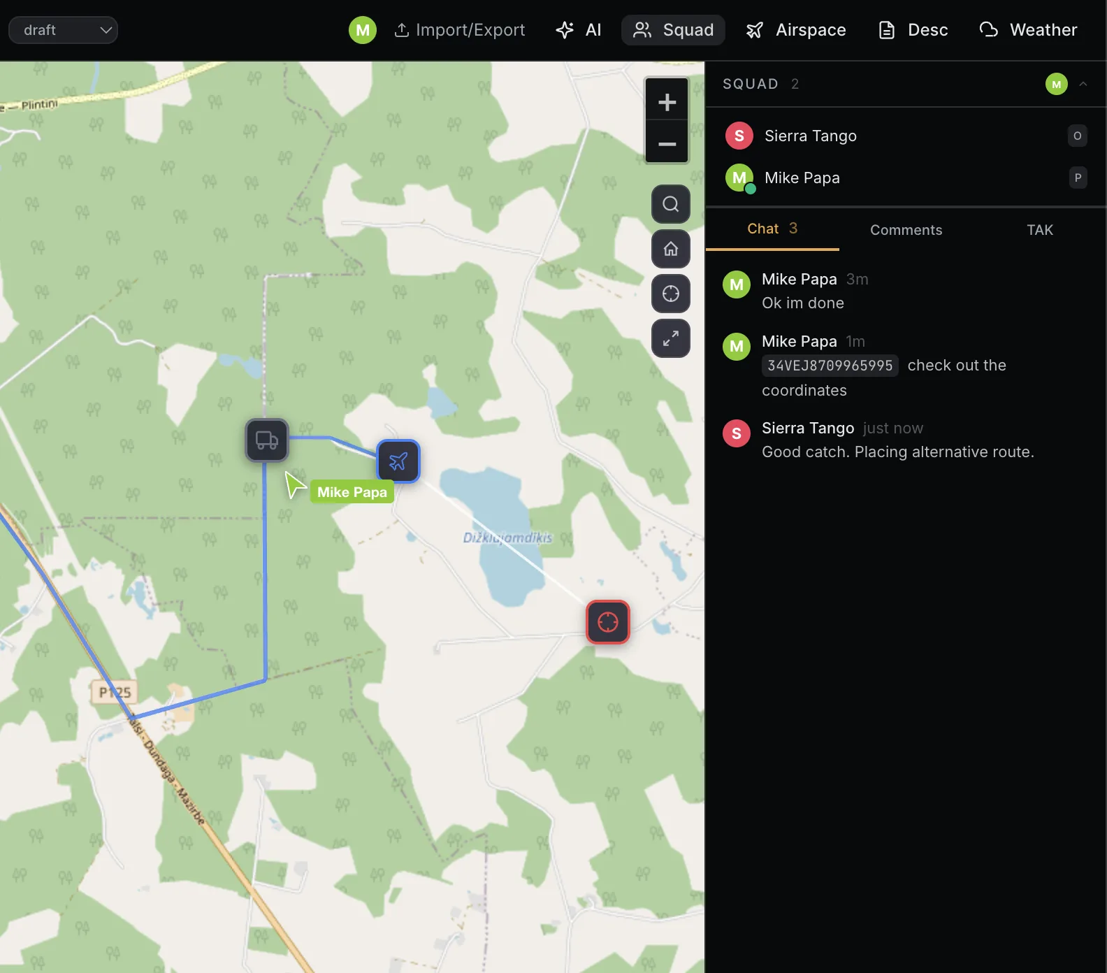
Collaboration
- Real-time cursors, presence indicators, instant sync
- Multiple operators plan on the same map simultaneously
- Built-in squad chat per mission
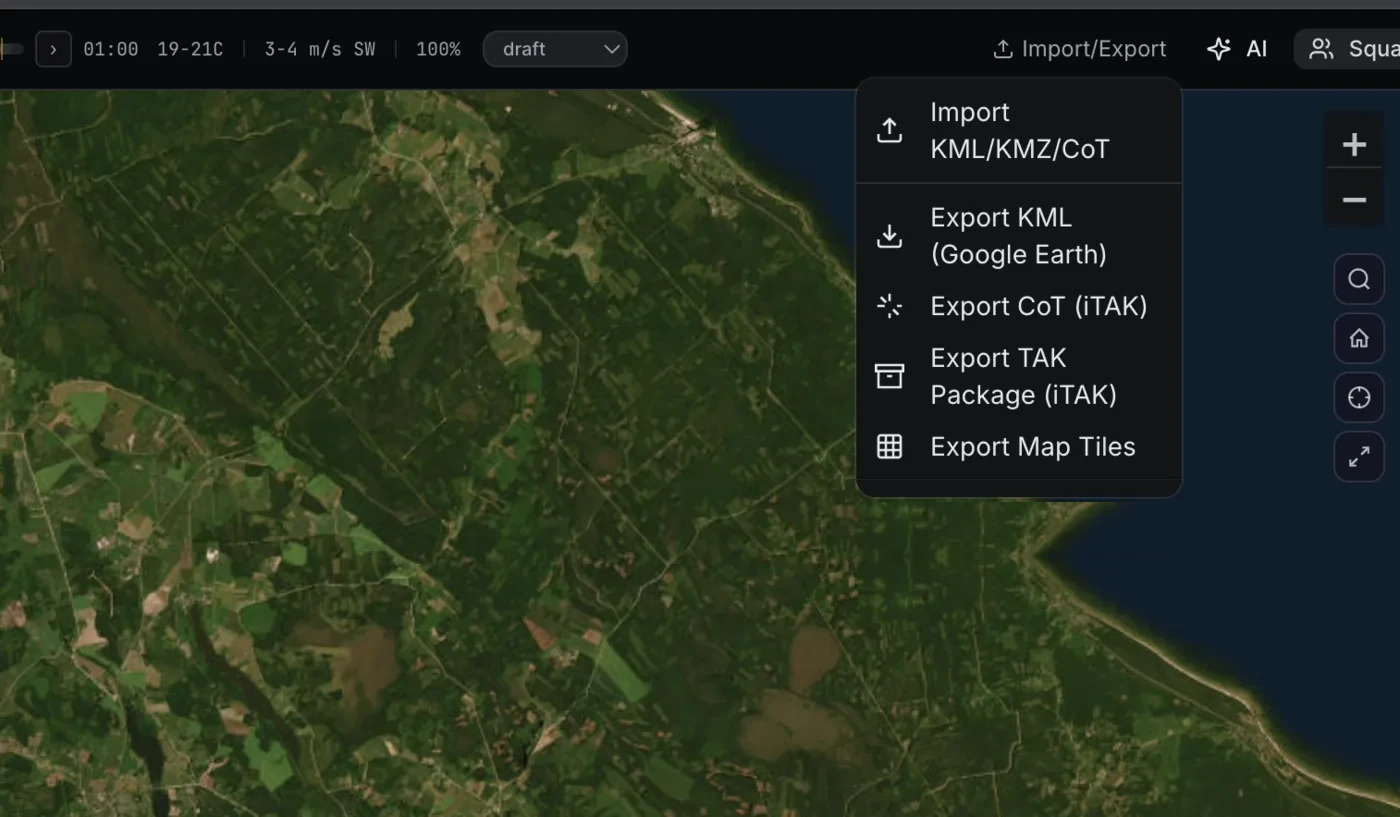
Import / Export
- Drag-and-drop KML/KMZ import from Google Earth
- Export to KML for ATAK or Google Earth
- Export CoT XML or a TAK Data Package for ATAK/WinTAK
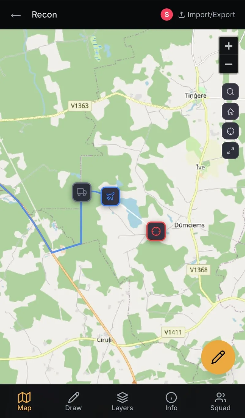
Mobile
- Responsive web app, works on tablets in the field
- Full undo/redo history, fast workflow
- No install required - open in any browser
ATAK / ITAK integration - push mission objects straight to TAK devices in the field.
Plan it from your own AI client
- MCP server with 18 tools - connect Claude Code or Claude Desktop
- Describe what you need and your client places it - markers, routes, zones, layers
- Grounded in live weather, airspace and NOTAMs, not in a model's memory
- Terrain analysis on tap: line of sight, viewshed, cover, launch and landing sites
Run it entirely on your own infrastructure
For teams that can't put mission data on someone else's cloud - defence, government, critical infrastructure. Everything runs on your box; the only dependencies on us are a signed license and coarsened reference data. You can watch the wire and confirm it.
The MCP server runs locally - attach your own model. AI-assisted planning happens entirely on your infrastructure; no mission context is sent to any external service.
Operator accounts, roles (planner / pilot / observer) and the audit log all live in your Postgres, created by your org admin - never transmitted to our cloud.
Verifiability is the point. The entire outbound heartbeat is { org_id, seat_count, app_version, nonce } - no operators, no area of operations, no mission content. Remote access runs over your own network (BYO VPN, Tailscale, Headscale, or WireGuard); we build no connectivity and are never in the path.
Ready to plan?
Free to use. Create an account, start a mission, place your first marker in under 30 seconds.
Get startedWant to start using OnVector? Get in touch -> hello@onvector.eu